
Bermuda keeping an eye on the progress of Hurricane Franklin
Published:Tuesday | August 29, 2023 | 10:29 AM
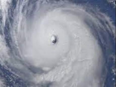
MIAMI, CMC – The Bermuda Weather Service (BWS) is predicting occasional gale-force gusts will pummel exposed elevations of the island on Tuesday as Hurricane Franklin, a formidable category four hurricane is expected to pass well to the northwest of Bermuda on Wednesday.
September and October are especially critical months in the annual Atlantic Hurricane season, which runs from June 1 to November 30 and National Security Minister, Michael Weeks, notes that the season is approaching its height.
The BWS warned the outflow boundary ahead of Hurricane Franklin was poised to deliver strong southerly gusts up to gale force, which will veer west-southwesterly as moderate to strong winds by the evening, turning westerly overnight
In its latest bulletin at 5 a.m. (local time), the Miami-based National Hurricane Center (NHC) said the hurricane is about 385 miles west south west of Bermuda with maximum sustained winds of 140 miles per hour (mph).
A Tropical Storm Watch is in effect for Bermuda and the NHC said that it means that tropical storm conditions are possible within the watch area, generally within 48 hours.
According to the NHC, the centre of Hurricane Franklin was located near latitude 30.2 North, longitude 70.8 West and is moving towards the north-northeast near nine mph.
“A north-northeastward to northeastward motion with a faster forward speed is expected during the next few days. On the forecast track, the centre of Franklin is expected to pass well to the northwest of Bermuda on Wednesday.”
It said maximum sustained winds have decreased to near 140 mph with higher gusts. “However, Franklin is still a formidable category 4 hurricane on the Saffir-Simpson Hurricane Wind Scale. Steady weakening is forecast during the next several days.”
The NHC said that life-threatening surf and rip currents generated by Franklin are already affecting Bermuda and the coast of the southeast United States.
“These conditions are expected to spread northward along the east coast of the United States and Atlantic Canada later today into Wednesday.”
Follow The Gleaner on Twitter and Instagram @JamaicaGleaner and on Facebook @GleanerJamaica. Send us a message on WhatsApp at 1-876-499-0169 or email us at onlinefeedback@gleanerjm.com or editors@gleanerjm.com.