
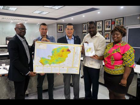
Geology map of MoBay completed - Report to assist in making development decisions
Published:Thursday | October 4, 2018 | 12:00 AMOkoye Henry/Gleaner Writer
WESTERN BUREAU:
Policymakers and stakeholders in Montego Bay, St James, should be better equipped to mitigate improper development procedures and practices thanks to the handover of a detailed geo-technical report and engineering geology map of the city.
Leighton Williams, deputy commissioner of mines (geology) in the Ministry of Transport and Mining, who made the presentation, stressed the importance of the tools in guiding the St James Municipal Corporation as well as developers and engineers in infrastructural development, which will enhance community resilience to natural disasters and geotechnical hazards.
"Given the city's many attractions, the tourist aesthetics and appeal, infrastructural development has been on the rise over several decades, and, unfortunately, this has happened in some areas that are deemed vulnerable to a range of geo hazards," explained Williams.
CONSEQUENCES BEING REALISED
"The development and urbanisation of some of these areas, particularly hillside areas, which are considered geological sensitive, has become common practice. Some of the consequences of this have been realised in Montego Bay, some as recently as within the last year."
Williams also noted that a number of formal and informal settlements have been established along many hillside areas in and around the Second City.
"Our research findings indicate that some of the areas are characterised by modern steep slopes, which are underlaid by geological materials that often are unsuitable or vulnerable to a wide range of hazards, including landslides, erosions, debris flow, and flooding of areas," said Williams.
Williams expressed the hope that the city would take a more proactive approach to disaster management, where vulnerable areas are clearly identified and that the tools would better enable the building approval process to determine the areas of suitability for development or civil engineering works.
David Brown, councillor for the Montego Bay North division, which was impacted by flood rains last year, said the report is most welcomed.
"It will point the corporation in the right direction on making better infrastructural development decisions," said Brown.