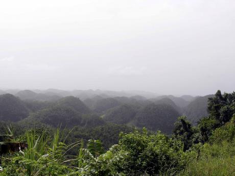
Earth Today | Cockpit Country boundary to become official this year
THE GOVERNMENT is, over the next few months, to make official the recently designated boundary for the ecologically sensitive Cockpit Country.
"What we need to do now, since we are not putting up a wall, is be very clear on where the line is; your pencil on the map may take up a couple hundred metres on the ground. So we have to go through with a fine-tooth comb to define where that line is on the ground," said Colonel Oral Khan, chief technical director (CTD) in the Ministry of Economic Growth and Job Creation.
"That is why we have to do a ground truth to see precisely where the boundary will lie, and then that is going to be gazette and become a part of the official records for where the boundary is," he added.
It is a process, the CTD said, that will be led by the Forestry Department, working in collaboration with the Water Resources Authority and with the involvement of the National Environment and Planning Agency (NEPA).
Players from civil society, meanwhile, are asking for a seat at the table as the process takes shape.
The Southern Trelawny Environmental Agency (STEA) has called specifically for a "government-appointed, broad-based stakeholder and bipartisan committee vested with the authority to craft a sustainable economic development plan for the Cockpit Country Protected Area".
The aim, according to STEA boss Hugh Dixon, would be "to submit a comprehensive plan to the Cabinet that can clearly identify sustainable economic activities that can be implemented to produce economic prosperity for Cockpit Country buffer zone communities and Jamaica's economy as a whole, in light of climate change".
ACCOUNTABILITY
Khan has said such a call could be considered.
"That suggestion has been mooted and I believe consideration can be given," he told The Gleaner.
What is currently on the table, however, is for the effort to be led by state entities and civil society consulted.
"There is to be prepared a management plan for this area that will now be declared, and in the course of the preparation of that plan, meetings will be held with those residing in the vicinity. I know that plans have also been worked on in the Ministry of Tourism for ecotourism that could take place in the environs. So there will be meetings and discussions, as the plans are developed," he said.
"The methodology has not been worked out yet, but it is the responsibility for the state and specific agencies. Forestry and NEPA will have lead roles to plan in that. I am very confident that they would want to do the broadest consultation in this. But the responsibility to have the plan prepared will not be left to civil society. The state and its agencies must carry that responsibility," Khan added.
Meanwhile, whatever the oversight committee looks like for the management plan, the CTD said civil society actors would no doubt ensure what was promised is what is delivered.
"This is one matter that the public has been very vigilant about, and this vigilance is going to be maintained. And it is not about the state versus civil society. We are protecting for future generations so there is not any attempt to cast any veil or do anything untoward. We have enlarged the area that is to be maintained and the citizens and watchdog groups will help to hold us to our word," he said.
The boundary decision, which followed years of robust debate and lobby involving not only environmental advocates, but also members of academia and private interests, was revealed by Prime Minister Andrew Holness on November 21 last year.
The designated area comprises "approximately 74,726 hectares and will be referred to as the Cockpit Country Protected Area and will be protected under specific legislation as advised by the attorney general".
This is according to the prime minister who said further that Cabinet had taken into consideration "the closed, broadleaf forest cover/primary forest, the rich biodiversity, the hydrology and the important historical, cultural sites", in settling on the boundary.


