Jamaica to benefit from UK’s help in mapping waters
Jamaica now has a better mapping of its underwater coastal infrastructure, thanks to the United Kingdom Hydrographic Office (UKHO), which recently funded a three-week capacity-building programme here to support safe maritime trade and the development of a sustainable blue economy.
Almost all activity in our oceans – from shipping to monitoring delicate marine environments – depend on accurate seabed-mapping data that illustrates the shape and movement of natural underwater features. The collection of this data is vital to supporting sustainable economic growth and protecting coastal communities from the effects of climate change.
As part of the UK government’s Commonwealth Marine Economies (CME) Programme, the UKHO also presented equipment and training to help Jamaica collect this data through seabed mapping surveys of its coastal waters.
The data will now be used to develop new nautical charts, which will be key to supporting sustainable maritime trade in the area. Further information collected through these surveys will be used to support disaster planning and resilience efforts, coastal infrastructure development and protection of natural resources.
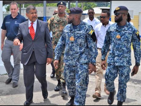
Rear Admiral (Ret’d) Peter Brady, director general of Maritime Authority of Jamaica, in welcoming the donation, said the multi-beam sonar equipment and training provided by the CME Programme will help to develop valuable skills and capacity, which will be of benefit to Jamaica for many years to come.
“As well as being used to allow vessels safe access to our ports and harbours, the data will be utilised in other disciplines such as fisheries and coastal zone management, environmental planning, and maritime security, and will also assist in the development of policies that protect our marine environment.
“The information gathered from surveys conducted in Jamaica’s waters will provide valuable support in the development of our blue economy, allowing us to manage the expansion of maritime trade and the sustainable use of our natural resources,” Brady said at the official handover of the equipment at the JDF Coast Guard base in Port Royal recently.
Meanwhile, British High Commissioner Asif Ahmad noted that mapping of the seabed around Jamaica has a tradition going back centuries.
“Mariners have relied on vital data to navigate safely in and out of Jamaican harbours using charts derived from mapping exercises. The CME Programme, funded by the UK, modernised the charts using the latest equipment last year. Now, the equipment is being handed over to Jamaica so that there will be local expertise to carry out future mapping of the seabed,” Ahmad said.
Representatives from the National Land Agency and Maritime Authority of Jamaica also participated in the training.

