Cedric Stephens | Contingency planning for a ‘slightly below average’ hurricane season
ADVISORY COLUMN: INSURANCE HELPLINE
The Jamaican government recently transferred $2 billion to the Contingencies Fund.
A contingencies fund, or contingency fund, is a reserve for emergencies. Think of it as an emergency bank account. The money is placed there to provide for anticipated disasters.
Finance Minister Dr Nigel Clarke moved a resolution in Parliament on March 26 to raise the Fund ceiling from $100 million to $10 billion “to provide space for future transfers related to natural disaster risk coverage”. The pre-fund transfer balance was a mere $94 million.
A recent study found that between 1993 and 2003, the country suffered from 26 natural disasters. They resulted in losses of US$2.22 billion. Ideally, resources in the fund should be enough to pay for at least one disaster each year.
The $2 billion transfer, the raising of the fund ceiling plus the pre-fund balance of $94 million should be viewed in the context of the country’s actual 11-year history and explains why “mitigation and resilience measures, post-disaster risk transfer measures on how to plan for and better finance damage and losses so that natural disasters don’t derail us from our objectives” are among the many things that are occupying the Finance Minister’s thoughts.
Disasters have been consuming the country’s resources for many years. The government has not had the funds to repair or replace the damage, find money to invest in new infrastructure and do all the other things it is required to do, all at the same time. It has been a Sisyphean Struggle.
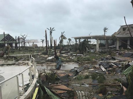
Hurricanes and floods occur more frequently than earthquakes. They have contributed to more damage than earthquakes. It is therefore important to ask: What is likely to happen during the June 1-November 30, 2019 hurricane season?
Many citizens have tended to follow the example of former governments. Threats are ignored until the last minute. Today’s column will follow Dr Clarke’s lead. It will share the predictions of Colorado State University’s hurricane researchers. Readers can, therefore, start to prepare their hurricane contingency plans.
The CSU Tropical Meteorology Project team is predicting 13 named storms during the upcoming Atlantic hurricane season. Researchers expect five of them to become hurricanes. Two are projected to reach major hurricane strength, Saffir-Simpson category 3-4-5 with sustained winds of 111 miles per hour or greater.
Researchers also say that:
• Tropical Atlantic sea surface temperatures are currently slightly below their long-term average values. This is considered an inhibiting factor for 2019 Atlantic hurricane activity as well;
• A weak El Niño has recently developed in the tropical Pacific. CSU anticipates that these weak El Niño conditions are likely to persist through the peak of the season. El Niño tends to increase upper-level westerly winds across the Caribbean into the tropical Atlantic, tearing apart hurricanes as they try to form;
• The tropical Atlantic is slightly cooler than normal right now. Colder-than-normal sea surface temperatures in the tropical Atlantic provide less fuel for tropical cyclone formation and intensification. They are also associated with a more stable atmosphere as well as drier air. These conditions suppress organized thunderstorm activity necessary for hurricane development; and
• The probability of a hurricane making landfall in the Caribbean this year is 39 per cent. The average for the last century is 42 per cent.
The team bases its forecasts on two models. One is a statistical model. The newer model uses a mix of statistical information and forecasts from a dynamic model.
Both models are built on about 40 years of historical data and evaluating conditions including: Atlantic sea surface temperatures, sea level pressures, vertical wind shear levels (the change in wind direction and speed with height in the atmosphere), El Niño (warming of waters in the central and eastern tropical Pacific), and other factors.
“So far, the projected 2019 hurricane season is exhibiting characteristics similar to 1969, 1987, 1991, 2002, and 2009. 1987, 1991, 2002 and 2009 had below-average Atlantic hurricane activity, while 1969 was a very active hurricane season,” said Phil Klotzbach, a research scientist in the Department of Atmospheric Science and lead author of the report.
The team predicts that 2019 hurricane activity will be about 75 per cent of the average season. By comparison, 2018’s hurricane activity was about 120 per cent of the average season. The 2018 season was most notable for hurricanes Florence and Michael which devastated the Carolinas and portions of the Florida Panhandle, respectively.
Forecast updates will be provided on June 4, July 2 and August 6.
This is the 36th year that the CSU hurricane research team has issued their Atlantic basin seasonal hurricane forecast.
Readers should not underestimate the threat In reviewing the forecast.
Last October the Associated Press published an article one year after Puerto Rico was struck by a Category 4 hurricane. One paragraph read: “Thousands of Puerto Ricans have been forced to drain their savings, close their businesses or resign themselves to living with structural damage after they fight insurance companies over millions of dollars’ worth of claims that have gone unanswered or unpaid, more than a year after Hurricane Maria”.
One of the features of a good hurricane contingency plan is that it is that insurance contracts are carefully reviewed and updated and the ‘what if’ question is posed and answered.
Cedric E. Stephens provides independent information and advice about the management of risks and insurance. For free information or counsel, write to: aegis@flowja.com

